Monday, July 6, 2015

Mt. Pinatubo: Beauty in Destruction

THE first ever eruption of Mt. Pinatubo in June 15, 1991 was recorded in history as one of the strongest not only in the Philippines but also in the world.


But did you know that before that fateful day, Filipinos–especially those living in the provinces of Tarlac, Pampanga and Zambales where the mountain sprawls–did not know that there is actually a volcano sleeping underneath the earth surface? For 500 years it laid dormant until it finally awoke–dangerous and deadly.

Thankfully, the Philippine Institute of Volcanology and Seismology (Phivolcs) and the United States Geological Survey (USGS) predicted the eruption early enough to allow evacuations that saved thousands upon thousands of Filipinos living in the region.

For 500 years it laid dormant until it finally awoke–dangerous and deadly
Still, Mt. Pinatubo’s eruption was so strong that it spewed big amounts of lava and volcanic ash. The effects of volcanic spews was further intensified by a typhoon caused massive lahar flow. It also emitted millions of tons of sulfur dioxide that was even reported to have contributed to the depletion of ozone layer.

More than two decades later, the once destructive Mt. Pinatubo is now a beautiful destination in the country. The communities surrounding it have also fully recovered and more importantly, have been even benefitting to the industries that came after the eruption—one of them is a bustling eco-tourism.

Go on 4×4

With a number of beautiful and exciting mountains scattered all over the Philippines, Mt. Pinatubo is considered as one of the most accessible to local and foreign tourists alike.

Located at the Cabulisan Mountain Range that snakes the provinces of Tarlac, Zamblaes, and Pampanga, Mt. Pinatubo is only a three-hour drive from Metro Manila.

After registration at Brgy. Sta. Juliana in Capas, Tarlac, go on a 20-kilometer, 4×4 vehicle ride to get closer to Mt. Pinatubo
Take-off points are found in four towns in Tarlac namely Capas, San Jose, Bamban and Mayantoc. Among them, Barangay Sta. Juiliana in Capas is the most popular because it houses the Satellite Municipal Tourism Office where all tourists are required to register whenever going to Mt. Pinatubo.

Today’s reminder of the
powerful 1991 eruption
But to prove that it is still part of nature, herds of cows could be seen dotting the surrounding. There is also what the locals call as the “Crow Valley Canyon,” a combination of green valleys and grey canyons. There are also rocky rivers and terrains that make the ride even more exciting.

Climb to the top
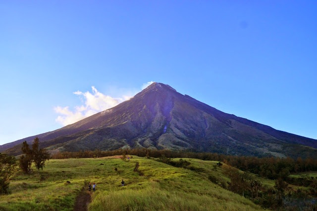
After the ride, visitors will then embark on another five-kilometer trek this time by foot to finally reach the crater. Although quite long, the trail is considered friendly because it doesn’t require a steep climb. Most part of the trek is on even dried soil and rubble, as well as solid lahar.

(caption) The hike will make one understand how powerful the 1991 eruption was

Along the way, make sure to greet the children of the Aetas—an indigenous tribe that still thrive within Pinatubo.

Also, the surroundings will also make hikers understand how powerful the 1991 eruption was. What was once mountains peaks transformed into walls upon walls of dried lava.

The destination gets closer when the trail becomes smaller and more vegetated. Finally, a man-made staircase climbs up to crater. Once there, just let the beautiful scenery take your breath away.

The local tour guide 
At the peak of Mt. Pinatubo is a caldera lake that is 2.7 kilometers wide. It was formed during the 1991 eruption when the volcano collapsed forming a cauldron shape in the middle.

This submerged piece of land then catches water so it becomes a lake. However, mineral deposits of the volcano still reach the lake that is why swimming is prohibited no matter how clear or cool the water is.

A hub for eco-tourism

Besides the Mt. Pinatubo Lake, the province of Tarlac is promoting other tourist destinations that make up an eco-tourism hub.

Group shot with media friends and ECCO execs at the crater
Also in Brgy. Sta. Juiliana is the Mt. Telakawa, an alternative mountain destination for visitors who are up for a more extreme hiking challenge.

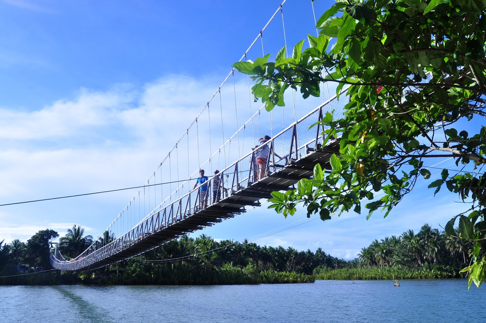
There are also scenic body of waters like the Duglo Falls in San Jose, the Siwako River in Bamban, and the Nambalan River in Mayantoc.

***

This story was originally published for The Manila Times. This trip was sponsored by ECCO shoes.

(TEXT AND PHOTOS: ©EUDENVALDEZ)

Saturday, June 13, 2015

Baler: Around Town

BALER is one of the oldest towns in the Philippines having marked its 400th year in August of 2011. Because of this, its culture is enriched by history and heritage as seen in its streets and structures, and as spoken by its people. 


Yet the capitol town of Aurora province is also teeming with adventures. Nestled in the Caraballo Range of the Sierra Madre Mountains and outlined by the Pacific Ocean in east, Baler is home to Sabang Beach, which is famous for surfing, as well as a number of other natural wonders--making it a promising hub for eco-tourism.

As a first-timer in this new land, I could say that all my cravings for culture and adventure were satisfied in a span of three days--with many more places left to see and experience.

In this story, join me as I followed Baler's historical trail starting from Kilometer Zero.

 Baler Church where the historic Siege of Baler took place
Baler's historical trail begins with its church, established by Franciscan priests using nipa and bamboo only at Sabang Beach in 1500s. Destroyed by a tsunami in the 17th century, it was transferred and built where it stands today.

Besides being the town's symbol of Catholicism and faith, the church is also a historical place as it is where Spanish soldiers last stood against the Filipino revolution from 1898 to 1899.

Quoting its historical marker: "A Spanish garrison of four officers and fifty men was besieged in this church by Filipino insurgents from June 2, 1898 to June 27, 1899. . . The garrison learned for the first time that the Philippines had been lost to Spain and that for many months, there had been no Spanish flag in Luzon, except the one waving over Baler Church."

A reproduction of the signatures of the Spanish soldiers who survived the Siege of Baler.
The original is displayed in a museum in Spain.
The brave Spanish soldiers had to endure so much from the equally brave Filipinos who fought for freedom at last. Many died from disease and some were killed. Those who survived from the siege were "rewarded by the Queen Regent" upon their return to their homeland.

After Baler Church, a visitor/tourist/wanderer then follows the trail (quite literal because there are actually footsteps imprinted at the the streets) to the residence of Doña Aurora Quezon, wife of Philippine Commonwealth President and Father of Filipino Language Manuel Quezon. Both hails from the town and lived very near from each other. (The provinces of Quezon and Aurora were named after the president and first lady, respectively.)

The residence of Dona Aurora, the wife of President Manuel Roxas
A local friend even told me, that the people of Baler believe that Doña Aurora and President Quezon were even related by blood (magkamag-anak?!).

Moving on, next stop is the town's Municipal Plaza. The current location of the plaza is where survivors of the December 27, 1735 tsunami rebuilt the new town hall, as well as the church. Only a few families survived by climbing up Ermita Hill, considered as one of the highest peaks of Baler.

I bet the monuments of Jose Rizal and President Manuel Quezon are enjoying this youthful scenery  
In front of the municipal hall, a monument of National Hero Jose Rizal stood the test of time. Beside him, a bust of Andres Bonifacio was also built. A few paces to his left, a monument of President Quezon was erected by former Sen. Edgardo Angara, also a favorite son of Baler thanks to the legacy left by his parents.

Also at the plaza is the "Baler 400 Years" commemorative monument by Filipino installation artist Junyee. It features four pillars interconnected by 100 horizontal lines to represent the town's four centuries of history. Again, it was commissioned by former Sen. Angara.

Museo de Baler was built at the site where Commonwealth President Manuel Quezon was born
Last on the list is the Museo de Baler located on a site where President Quezon was born on August 19, 1878. The Commonwealth president is very much associated to Baler that even up to this day, many Filipinos still think that the town is still part of Quezon province. (Aurora used to be part of Quezon until it was created a province in 1979 and Baler was chosen to be its capitol town.)

The museum is built only in 2003 again through the efforts of the Angaras. Large and old trees surround the museum, and in the middle, sits a very majestic sculpture of President Quezon.

The museum features a traditional structure covered in red bricks and bronze bas-reliefs depicting historical moments of the Philippines.

Inside, a collection of town artifacts are found, as well as contemporary collections in partnership with other institutions like the Instituto Cervantes Manila.

Beyond the historical trail, there is also so much more to see in downtown Baler. Here are the sights I spotted and shot:

Balerianos are devout of the Nazareno too; The defunct Bank of Baler spotted
(Clockwise from top left) The old Georgina Cinema, the town market, an old establishment and a printing press


Baler in numbers:

9,255 hectares: land area;
about 39,109: population;
3rd class: municipality;232 kilometers away from Manila with
4 to 8 estimated travel time.

(TEXT AND PHOTOS ©EUDENVALDEZ)

RELATED STORY: 
Baler: Beyond Sabang

Monday, June 1, 2015

Baler: Beyond Sabang

SUMMER is not yet over. While we are experiencing rains and thunderstorms these days, the Philippine Atmospheric, Geophysical and Astronomical Services Administration (PAGASA) has predicted that the rainy season will come middle of June.


That only means that there is still time to catch your one last epic summer adventure. Those in search for one could head over to the town of Baler in Aurora province. There, you can enjoy the big waves of Sabang Beach and try surfing for the first time.

An already known surfing destination in Northern Philippines, local tourists are seen lining the shore of Sabang on top of surfboards. Why not when surfing lessons come at a very affordable P300 fee per hour.

But while many go to Baler expecting to hit the waves, surprisingly though, this quaint and historical town in Luzon have more water escapades to offer.

Here are other “wet” destinations you can visit when in Baler:

Dicasalarin Cove

Dicasalarin Cove and Bay is a hidden paradise found at the southeastern area of Baler, which opens up to the vast Pacific Ocean.

The secluded Dicasalarin cove is truly less crowded compared to the famous Sabang Beach
There, a rustic resort, which is owned by the political and public servant family of the Angaras. According to locals, former Sen. Edgardo Angara Sr. could be seen lounging around in his personal villas on weekends. Everyone needs peace and quiet and I’m sure he finds it at Dicasalarin Cove.

More villas are available for accommodations for people who want to spend more time at the secluded cove–away from all of Sabang Beach’s crowd and happenings.

The Pagasa satellite office is responsible of monitoring weather patterns over the Pacific Ocean
But for those pressed with time or budget, they could always opt for a day tour and just pay the resort’s entrance fee. Here’s what to do:

  • Swim! Take a dip at the beach’s clear water with friendly waves. Also, the sand is white so if you are a beach person, this is the perfect place for you.
  • Climb! Go up the steep stairs of one of the hills in Dicasalarin where a lighthouse sits on top. And once there, challenge yourself once more to climb the metal stairs of the lighthouse. If not brave enough, just savor the view of the surroundings including rock formations, mountains and the vast Pacific Ocean.After the cool dip and exciting climb, take a break at the resort’s restaurant that serves good pizza. Or walk to the Artist’s House which serves as a gallery with local artworks, photographs, and sculpted wooden furniture.
  • Visit PAGASA. When going to Dicasalarin Cove, make sure to stop by the PAGASA station, which you will pass by. Found at the highest point of the cove’s mountain, its location is perfect to monitor the weather patterns of Northeastern Luzon. Take time to talk to the weather forecasters and observers to understand the importance of their work.
  • Digisuit Beach 

If Sabang Beach boasts of crashing waves, Diguisit Beach is proud of its rock formations
While you can also swim in the beach, it’s more fun to explore the various rock formations–big or small–which can be accessed and climbed by foot when the tide is low.

Hanging Bridge 

Baler’s hanging bridge Sure is sturdy
Last stop before you head back to Baler’s Sabang or town proper will be the favorite destination of locals and visitors alike, the hanging bridge.

Are you adventurous enough to cross the hanging bridge? Well, there is nothing to worry because the bridge is now safe and secure except of course for the bumpy and shaky feeling when people are crossing.

Once made of only wooden planks and ropes, the hanging bridge is now reinforced
My brother tells me that its condition now that tourism is picking up in Baler has greatly improved. Before, it used to have missing wooden planks!

These are just some of the other destinations featuring bodies of water that you can visit in Baler besides Sabang. Make sure to check them out the next time!

(TEXT AND PHOTOS ©EUDENVALDEZ)

RELATED STORY:
Baler: Around Town.

Saturday, May 9, 2015

Albay: The ultimate Mayon adventure


THE moment I arrived at Legazpi International Airport in Legazpi City in Albay province, I got my first glimpse of the Philippines’ most prized Mayon Volcano, known around the world for its perfect inverted conical shape.


And I immediately realized that the Mayon (derived from the Bikolano word magayon which translates to beautiful in English) was majestic and imposing than all its pictures I had ever seen. I never imagined it to be that beautiful and big as it sits right in the middle of Albay’s three cities and 15 municipalities and towers at almost 8,000 feet above sea level.

However, within my two days spent at Albay, Mayon seemed to enjoy teasing me as there were always clouds surrounding her, sometimes at the base but most of the times at its crater.

The tease that is Mayon is always hiding its peak
Thus, I couldn’t wait to see Mayon in its full grandeur!

Finally after the long wait–that included the Daragang Magayon beauty pageant’s coronation night in

Legazpi capital and a day tour of Camalig town–I finally got my fill of Mayon in an adventure beyond my wildest imagination.

Thanks to the Department of Tourism by allowing the media junket I was part in to take the ATV ride to Mayon Volcano offered by Bicol Adventure, found in the town of Daraga.

Bicol Adventure ATV has four kinds of ATV and four different trails to choose from
Arriving late in the afternoon, Bicol Adventure assistant manager and trail master and designer John Morales immediately welcomed us and assisted us in taking initial ATV driving lessons.

As a first-timer aware of ATV horror stories, I bravely took on a single ATV! Thankfully, Bicol Adventure drivers/guides/instructors handled us professionally and carefully. I finished the beginner’s practice lane which included going uphill and downhill, as well as a rocky stream.

 A montage of photos taken from a high point in Mt. Mayon
After that quick trial, the whole group through the recommendation of Sir John decided to ride with Bicol Adventure’s drivers so that we could catch the sunset at Mayon’s Green Lava Trail 3 that is approximately 11 kilometers from base and 3,000 feet above sea level!

Riding with our separate trail guides, the Manila media group left at approximately 5 p.m. After passing by all kinds of terrain: river where lava flows, small streams rugged by volcanic rocks, flat roads filled with volcanic ash, communities and mountain vegetation, we finally arrived at our destination, the drive took about 45 minutes.

And although we weren’t prepared physically (not only from the bumpy ride but also from bathing in and breathing dust), the view was worth it.

At 360 degrees, I savored the majestic Mayon, which by then came out in full; the Albay Gulf, which faces the province of Sorsogon and according to my guide Lhanz, we were lucky also because clouds cleared and also showed Mt. Bulusan, an active volcano just like Mayon; the rest of Daraga and Legazpi City; and finally the beautiful setting sun.

Everything just took my breath away.

According to my trail guide Lhanz Asuncion, Green Lava 3 is the highest trail offered via ATV in Albay. Bicol Adventure’s two competitors only traverse the Black Lava trail which reaches only the lava wall at 900 feet above sea level.

Besides being informative, Lhanz is also a success story thanks to Albay’s teeming tourism. After doing odd jobs in Manila, Lhanz returned home and found a job he is passionate about: riding while sharing the beauty of his land’s treasure, the Mayon.

At approximately 3,000 ft of Mayon Volcano, membees of the Department of Tourism’s media junket beams with joy

On the way back, it was getting dark already and where better to pass than a ghost town? My trail guide and driver Lhanz ably noted the old community that was ruined by the powerful 18th century Mayon eruption that also buried the Cagsawa village (the church bell tower a visual reminder). Left behind were houses, a school and the church now part of the six-kilometer radius permanent danger zone.

Nevertheless, this only added to the thrill!

So ultimately, ATV ride at Mayon Volcano is something I would love to do again. See you Albay!

Lhanz Asuncion (right) with a fellow trail guide

***

Visit Bicol Adventure to know their complete list of services and rates. You can also contact John Morales at 0948-9542702, or Lhanz Asuncion at 0927-5022991

(TEXT AND PHOTOS ©EUDENVALDEZ)
Powered by Blogger.